Fitzgerald River National Park (FRNP) is a one of the larger parks in WA at nearly a million acres but is mostly inaccessible wilderness. We saw a minute part of the mountainous coast that offered a 50K walking trail divided into 4 segments that were easy to reach. We had to drive over 3 hours around the top of the park to reach the west side. During our stay we camped near two other couples and during our hike we saw a total of six people on the wooded section and no one on five miles of beach. The park was recently upgraded and had new roads and new campground facilities. To see all of this devoid of people was strangely eerie and rather a shame.
This morning sunrise was captured a short walk from our campsite at Four Mile Beach in FRNP
A few hours later this was the scene along the FRNP coast
The Hakea Trail follows the beach in FRNP and the Sooty Oystercatchers were running away from the approaching waves, just like we do.
The wind picked up and mares tails were everywhere on the surf.
The hakea is native to Australia and can reach 6 metres in height. I thought they resembled a cabbage
WA is home to the largest herd of feral camels in the world, but these are probably domesticated
Views from the hilltops in Albany (population 34,000) indicate that the city is surrounded by water on 3 sides. It is a mountain bikers haven and the lengthy coastline is on the whale migration path during winter – we were a month too early.
Just outside of Albany in Torndirrup National Park, hiking down one side of the isthmus, around the hammer, and back up the other side was an interesting walk.
Two People Bay is a great place to fish from the rocks. These have anchor points for the fisher to attach to.
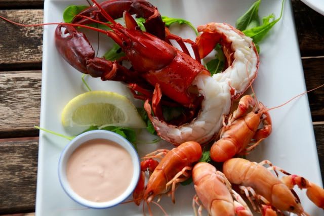
Marron is a type of crayfish that is similar to lobster. The smaller orange critter is also a crayfish but not as delectable and doesn’t grow as large.
When we “camp” in national parks we have no heat so we crawl into bed early in the evening and I might work on the computer dressed in my down sweater till, oh say 9:30pm
The TV that came in our van is really only good as a DVD player but Joe fixed that little red wagon by building his own antenna. As long as we are in a fair-sized town this actually works.
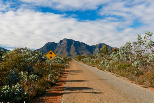
The Stirling Range is another hotspot for biodiversity and is home to the highest peak in the south half of Western Australia, Bluff Knoll, at 1,095 metres. We made the climb which was 3 kilometres of intense climbing to reach the highest point you see in the picture above. Our total ascent was 668 meters.
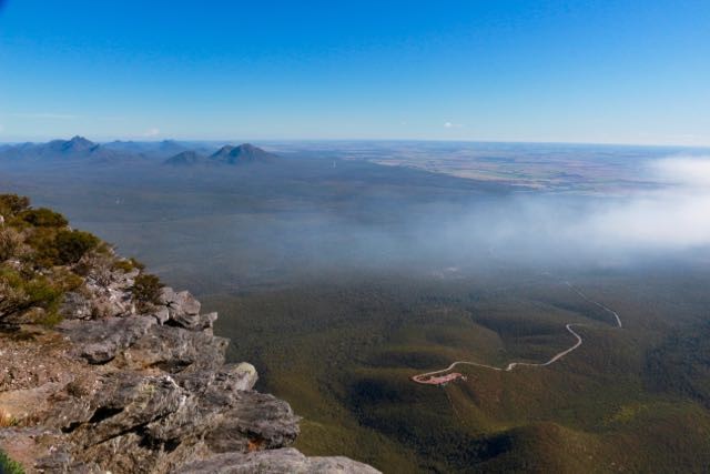
This is the view from the top of Bluff Knoll. Our van is the tiny speck in the red carpark
This is another view from the top of Bluff Knoll.
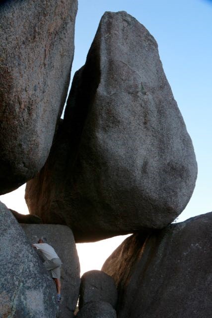
Porongurup National Park is a range of mountains just 12 kilometres long. It’s distinctive granite domes are massive. The next 4 shots are at the Castle Rock “Granite Skyway” a bizarrely engineered walkway connecting and supported by several on the huge domes. An enclosed ladder gives access to the walkway. The views from it are pretty amazing. Here Joe is beginning to scale the rocks with the help of some large handholds.
From the top the Stirling Range is easily visible to the north.
And the access ladder to the Granite Skyway
For a little diversity, a couple cows were sneaking a peek at us while we had lunch near the town of Denmark
The Bibbulmun Track is a 1,000 kilometre walking trail that starts in Albany & ends in Perth. At this point when the tide is out, one can walk across this inlet to reach the continuation of the track on the other side. A bike track runs nearly parallel to the walk track the entire route as well.
Sunset on the Denmark River right next to our campsite